No sooner do I turn around and a month has gone by. Track markers, speed limits, portals and checking things in general have taken up the bulk of my time but I have worked a bit on scenery even though I promised myself I would not. Some WIP shots of an area I have no confidence that is even relevant anymore but, indulging in a bit of route/artistic license, I am fleshing it out in order to include a bit more work for locals regardless of whether it is prototypical or not.
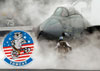
USAF Plant 42... or is it Palmdale Regional Airport... or is it both? I find it hard to imagine it being a public airport when there is a U-2 and a handful of drones parked on the tarmac near the old/present? Northrop-Grumman section. So, with that being said I am leaning towards keeping it as an active USAF/Research facility.
Panorama of the Lockheed Martin section. Skunkworks on the left and Lockheed Aeronautics just right of center.
Lockheed Martin01.jpg
View from the Mainline/Siding.
Lockheed Martin02.jpg
Pulling out of the Skunkworks looking towards Lockheed Martin Aeronautics.
Screenshot_Cajon_Mojave_34.62138--118.11171_06-02-28.jpg
Lockheed Martin Aeronautics.
Screenshot_Cajon_Mojave_34.62152--118.12056_06-01-05.jpg
You do not have the required permissions to view the files attached to this post.
Download the PRB from page 51 of the Powder River Basin thread.