Logo without slogan...
... Very condensed with essential info, text re-inforces calligraphy logo
QcRail
Trinity County Narrow Gauge
Re: Trinity County Narrow Gauge
![]() by QcRail » Mon Sep 17, 2018 2:33 pm
by QcRail » Mon Sep 17, 2018 2:33 pm
You do not have the required permissions to view the files attached to this post.
QcRail. aka Bernard Lafargue
- QcRail
- Posts: 475
- Joined: Fri Jun 29, 2012 1:17 pm
- Location: Montréal, Qc. Canada
Re: Trinity County Narrow Gauge
![]() by QcRail » Mon Sep 17, 2018 5:02 pm
by QcRail » Mon Sep 17, 2018 5:02 pm
First attempt to have a N.G. boxcar
Quite incomple, needs all car markings, logo ajustment and a little weathering
QcRail
Quite incomple, needs all car markings, logo ajustment and a little weathering
QcRail
You do not have the required permissions to view the files attached to this post.
QcRail. aka Bernard Lafargue
- QcRail
- Posts: 475
- Joined: Fri Jun 29, 2012 1:17 pm
- Location: Montréal, Qc. Canada
Re: Trinity County Narrow Gauge
![]() by McCRRR19 » Mon Sep 17, 2018 7:37 pm
by McCRRR19 » Mon Sep 17, 2018 7:37 pm
KevinWS: I like the logo you made using the triangle the better than the circle, especially since it brings the "Trinity" idea into play. The simplified trees from your circle logo might work a little better as something that would be stenciled on the side of a car.
QCRail: I like the car so far, also with the logo, it might look a little more balanced with the "Trinity County Narrow Gauge" more centered in the borders instead of towards the upper and lower corners, if that makes sense.
I the logos both of you have created used on the sides of the equipment, as it'll give some variety and help represent cars from different periods of the railroads history. The D&RGW, C&S and other narrow gauges had a variety of ways cars were painted, no reason the TCNG can't have the same.
I took out my pencil and did some sketches with both logos on the side of a boxcar to show how I was thinking the boxcars would look.
You do not have the required permissions to view the files attached to this post.
Tim Stricker
Pierre, SD
Pierre, SD
- McCRRR19
- Posts: 75
- Joined: Sun Oct 14, 2012 6:42 pm
- Location: Pierre, SD
Re: Trinity County Narrow Gauge
![]() by QcRail » Mon Sep 17, 2018 10:55 pm
by QcRail » Mon Sep 17, 2018 10:55 pm
Tim,
I love it when someone uses a common lead pencil to simply express an idea.
The uncentered words were placed on purpose - get a reaction to another possibility; now I know your preference
I will refine my proposal (if only for my personnal use) and will also produce what your sketch suggest Also, good to remember, railroads did have variants to its basic scheme - Colorado and Southern had at least 3 distinctive heralds or logos, maybe more :)
By the way, it may not be possible to center the arched TCNG letters, above the car number as the actual autonumbering is quite offset to left of panel - a fixed parameters in the 16 element matrix of the shape file. You should contact Johatan Lewis to have him do a second version with a centered auto-number
Would love to hear critics from all other simmers, anyway I'm having fun
QcRail
I love it when someone uses a common lead pencil to simply express an idea.
The uncentered words were placed on purpose - get a reaction to another possibility; now I know your preference
I will refine my proposal (if only for my personnal use) and will also produce what your sketch suggest
Also, good to remember, railroads did have variants to its basic scheme - Colorado and Southern had at least 3 distinctive heralds or logos, maybe more :)By the way, it may not be possible to center the arched TCNG letters, above the car number as the actual autonumbering is quite offset to left of panel - a fixed parameters in the 16 element matrix of the shape file. You should contact Johatan Lewis to have him do a second version with a centered auto-number
Would love to hear critics from all other simmers, anyway I'm having fun
QcRail
QcRail. aka Bernard Lafargue
- QcRail
- Posts: 475
- Joined: Fri Jun 29, 2012 1:17 pm
- Location: Montréal, Qc. Canada
Re: Trinity County Narrow Gauge
![]() by KevinWS » Mon Sep 17, 2018 11:17 pm
by KevinWS » Mon Sep 17, 2018 11:17 pm
Thanks Tim.
When I get a gap I will redo the triangular theme as a simpler stencil - as per your suggestion.
When I get a gap I will redo the triangular theme as a simpler stencil - as per your suggestion.
Kevin
-
KevinWS - Posts: 185
- Joined: Tue Feb 17, 2009 12:44 am
- Location: South Africa
Re: Trinity County Narrow Gauge
![]() by KeggWorks » Sun Sep 23, 2018 11:06 pm
by KeggWorks » Sun Sep 23, 2018 11:06 pm
QcRail wrote:Logo without slogan...
... Very condensed with essential info, text re-inforces calligraphy logo
QcRail
I'm liking the look of this logo! Reminds me a LOT of the one I used for the Mojave & Panamint route I was working on in TRS.
- KeggWorks
Re: Trinity County Narrow Gauge
![]() by SAR704 » Thu Sep 27, 2018 10:07 pm
by SAR704 » Thu Sep 27, 2018 10:07 pm
That route certainly looks more realistic with an actual embankment loft, instead of using the default tools.
Geforce GTX 1060
16GB RAM
Intel Core i5-3350 3.10ghz
Win te(n) Home
16GB RAM
Intel Core i5-3350 3.10ghz
Win te(n) Home
- SAR704
- Posts: 716
- Joined: Tue Jun 21, 2011 9:48 am
- Location: Adelaide, South Australia
Re: Trinity County Narrow Gauge
![]() by McCRRR19 » Sun Oct 07, 2018 3:08 pm
by McCRRR19 » Sun Oct 07, 2018 3:08 pm
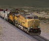
Some work on the lower reaches of the Trinity River Canyon. This is in a series of reverse bends in the river downstream from Lewiston. The exact location here is about a quarter mile below a location labeled as "Poker Bar" on various topo-maps. Here a Weaverville bound freight traverses the stone shelf above the Trinity River.
Also nearby and keeping with one of the main industries in the area, a small placer mining operation works the gravel on the opposite side of the river.
One of the asset providers I've been using is the German "SAD" and among those assests I found something that was labled as brambles, which turned out to be blackberry bushes. Which, I absolutely had to use, as it is not uncommon to find them in the area, especially along streams around Weaverville and the lower Trinity River among many other places in California.
You do not have the required permissions to view the files attached to this post.
Tim Stricker
Pierre, SD
Pierre, SD
- McCRRR19
- Posts: 75
- Joined: Sun Oct 14, 2012 6:42 pm
- Location: Pierre, SD
Re: Trinity County Narrow Gauge
![]() by ozinoz » Fri Nov 23, 2018 5:03 pm
by ozinoz » Fri Nov 23, 2018 5:03 pm
We haven't forgotten this beauty, or at least I haven't 
Hope things are progressing well...

Hope things are progressing well...
- ozinoz
- Posts: 1622
- Joined: Fri Feb 20, 2009 1:59 am
- Location: Antipodes
Re: Trinity County Narrow Gauge
![]() by McCRRR19 » Mon Nov 26, 2018 7:04 pm
by McCRRR19 » Mon Nov 26, 2018 7:04 pm
ozinoz wrote:We haven't forgotten this beauty, or at least I haven't
Hope things are progressing well...
Things are moving slowly, been busy as of late, but it's still here. :)
You do not have the required permissions to view the files attached to this post.
Tim Stricker
Pierre, SD
Pierre, SD
- McCRRR19
- Posts: 75
- Joined: Sun Oct 14, 2012 6:42 pm
- Location: Pierre, SD
Re: Trinity County Narrow Gauge
![]() by McCRRR19 » Wed Dec 12, 2018 1:31 am
by McCRRR19 » Wed Dec 12, 2018 1:31 am
A little bit more progress. First a shot of a freight departing the Trinity Center yard. The area is still a work in progress. The car shop is the to the right, with the paint shop just beyond it with the caboose track next to it. The depot can barely be scene in the distance.
Next, about a half mile north of Trinity Center the line crosses a road known as "North Fork Cutoff". The road runs along the north side of Swift Creek (which I haven't had the chance to model yet). From what I recall, prior to the filling of Trinity Lake, the road used to run down and cross the Trinity River then continue up to the mountains on the other side and cross the Shasta-Trinity Divide. From there you could drop down to the Sacramento River Canyon to Delta and the old US 99 via Dog Creek Road, or you head south towards French Gulch and Whiskeytown and continue down into Redding. So here in these two shots a freight crosses the North Fork Cutoff, the road can be seen disappearing in to the lake in the distance. Today, where the road terminates at the edge of the lake (which fluctuates depending on lake level) is the location of the Wyntoon Campground and Resort boat docks. The campground used to be ran for many years by a very friendly German couple, but they retired and sold the campground a few years and it is now owned by KOA, not quite the same, but still a great place to go camping. I used to go up there camping with the family once or twice a year growing up.
Continuing on in the Trinity Center area, here about a mile north of Trinity Center, is another work in progress area. This is near where Trinity Center used to be located prior to the filling of Trinity Lake. The train is crossing a fill of what is known as Flume Creek. The surrounding hillsides saw a large amount of hydraulic mining which also decimated the creek bed. I've hiked around the area, and I've been trying to replicated how I recall seeing it. It's an evolving area, and may continue to change to help get the feel for an area still recovering from the devastation created from hydraulic mining.
Finally, a freight from Hayfork bound for Trinity Center drifts down the 4% grades towards the Trinity River.
You do not have the required permissions to view the files attached to this post.
Tim Stricker
Pierre, SD
Pierre, SD
- McCRRR19
- Posts: 75
- Joined: Sun Oct 14, 2012 6:42 pm
- Location: Pierre, SD
Re: Trinity County Narrow Gauge
![]() by ozinoz » Wed Dec 12, 2018 3:18 pm
by ozinoz » Wed Dec 12, 2018 3:18 pm
LOVE that broadside down the dirt road with the mountains peeking between the row of trees over the crossing - so much atmosphere...
- ozinoz
- Posts: 1622
- Joined: Fri Feb 20, 2009 1:59 am
- Location: Antipodes
Re: Trinity County Narrow Gauge
![]() by McCRRR19 » Tue Apr 23, 2019 11:31 pm
by McCRRR19 » Tue Apr 23, 2019 11:31 pm
Progress lately has been slow going. Work and other video games have had my attention lately (primarily Red Dead Redemption 2 and Assassin's Creed: Odyssey). Anyways, I have some work in progress shots of some of the communities along the TCNG that I've been working on recently. Things so far are basic, and more details will be added.
First off, is the town of Callahan. This little community along the Scott River is where the grade increases for the climb up to the summit at Scott Mountain. All trains stop here for water before making starting the climb. Callahan is also the furthest south the little Scott Valley local runs, which switches the hand full of industries between Etna and Callahan, which are mainly spurs for a couple of dredges and the Hjertager Sawmill a mile north of Callahan.
The real Callahan began it's start in 1851 as a stage stop started by M.B. Callahan. In 1858 a post office was opened under the name "Callahan's Ranch" which was later shortened to "Callahan" in 1892. Some maps I've seen even labeled the town as "Callahan's". The Callahan Hotel and stage stop (which is still standing) served as the inspiration for the Siskiyou County Historical Society Museum in Yreka. A darker part of Callahan's history, is it was the location of the last lynching in California. January 6th, 1947, a man was found hanging from a tree in front of the schoolhouse. A crime which has never been solved.
Next up we move further south over Scott Mountain and down to the Trinity River to the northern edge of Trinity Lake. Here is the little mining community of Carrville. Carrville's history goes back to the 1860's when it was established as a stage stop on the California-Oregon Stage Rd. completed in 1860. The town was named for James E. Carr, who was instrumental in building the stage road. The area was heavy with mining, with the entire valley floor between Carrville to Trinity Center being torn up by massives dredges searching for gold. Besides placer mining, several hard rock mines were located in mountains in the area, most notably, the Bonanza King Mine, and the Headlight Mine.
Further south below Trinity Dam, is the little town of Lewiston. Lewiston is named for Benjamin Franklin Lewis who built a trading post and ferry in the early 1850's on the old route from Shasta to Weaverville. After the discovering of gold a post office was established in 1853. The construction of Trinity and Lewiston dams starting in the mid-1950's helped to keep Lewiston from becoming a ghost town. In the mountains about Lewiston to the east, was a another little community known as Deadwood (the mountains are too steep to build a railroad up there) but it was the location of the Brown Bear Mine, a hard rock mine, it was one the biggest producers of gold and was last work in 1950. The mine supposedly produced $7 to $10 million worth of gold. However, most mining in the area around Lewiston was done as some form of placer mining, mainly by dredges or hydraulic.
You do not have the required permissions to view the files attached to this post.
Tim Stricker
Pierre, SD
Pierre, SD
- McCRRR19
- Posts: 75
- Joined: Sun Oct 14, 2012 6:42 pm
- Location: Pierre, SD

64 posts
• Page 4 of 5 • 1, 2, 3, 4, 5
Who is online
Users browsing this forum: No registered users and 1 guest