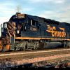
TDHenderson wrote:Tomcat,
For reference, here is what I have laid out so far for the Black Hills High Line marker and terrain wise. Just need the expertise to build it.
What time period are you looking to re-create? and what DLC are you thinking of using for the scenery?
I've spent the past few days looking over the area and I must admit it is an interesting subject for a route. I was wondering how difficult it would be to lay the track since the line is long abandoned but then I realized the old right-of-way has been turned into the George S. Mickelson Trail which is fairly easy to follow with Google Earth overlay in the editor.
I've got a long haul in front of me to finish the Powder River Basin but this is intriguing. I don't think I would want to add it into the PRB route since I'm sticking with a relatively modern presentation and in addition, I'm not sure I can include all the track I want in my route. I figure, roughly, that by the time I get to putting in Guernsey and getting past the double horseshoe curve at Crawford Hill I might be pushing the limits of the tracks.bin file with 1200 miles total track, then there would be the additional 160 miles to make it to Alliance and then on to Guernsey before even placing however many miles of track are in the yards at Alliance. Putting in the yards at Alliance might very well push the whole thing over the edge. I may have to prune those yards down in a major way if I can put them in at all.
If nothing else, the High Line would make for an incredibly scenic route.