Has anyone else been getting a 404 error from the USGS Data Distribution Service? https://dds.cr.usgs.gov/srtm/version2_1/SRTM1/
It was an awesome resource to download ready to go hgt files.
US SRTM DEM Data
US SRTM DEM Data
![]() by wlenz781 » Sun Feb 14, 2021 6:41 pm
by wlenz781 » Sun Feb 14, 2021 6:41 pm
- wlenz781
- Posts: 306
- Joined: Wed Dec 14, 2016 5:15 pm
- Location: Joplin, Missouri
Re: US SRTM DEM Data
![]() by buzz456 » Sun Feb 14, 2021 6:50 pm
by buzz456 » Sun Feb 14, 2021 6:50 pm
See if you can get what you are looking for from here.https://www.usgs.gov/core-science-syste ... m-delivery
Buzz
39 and holding.
"Some people find fault like there's a reward for it."- Zig Ziglar
"If you can dream it you can do it."- Walt Disney

39 and holding.
"Some people find fault like there's a reward for it."- Zig Ziglar
"If you can dream it you can do it."- Walt Disney
-

buzz456 - Site Admin
- Posts: 21391
- Joined: Sun Mar 21, 2010 8:30 am
- Location: SW Florida
Re: US SRTM DEM Data
![]() by kris120 » Sun Feb 14, 2021 6:52 pm
by kris120 » Sun Feb 14, 2021 6:52 pm
Try http://viewfinderpanoramas.org/Coverage ... s_org3.htm
They don't have exactly the same files like usgs, but quality is the same or better.
Therefor you may have to smooth out edges at the transitions to your previous import.
They don't have exactly the same files like usgs, but quality is the same or better.
Therefor you may have to smooth out edges at the transitions to your previous import.
-

kris120 - Posts: 482
- Joined: Mon Jul 22, 2013 3:19 pm
- Location: Augsburg, Bavaria, Germany
Re: US SRTM DEM Data
![]() by BoostedFridge » Sun Feb 14, 2021 7:33 pm
by BoostedFridge » Sun Feb 14, 2021 7:33 pm
wlenz781 wrote:Has anyone else been getting a 404 error from the USGS Data Distribution Service? https://dds.cr.usgs.gov/srtm/version2_1/SRTM1/
It was an awesome resource to download ready to go hgt files.
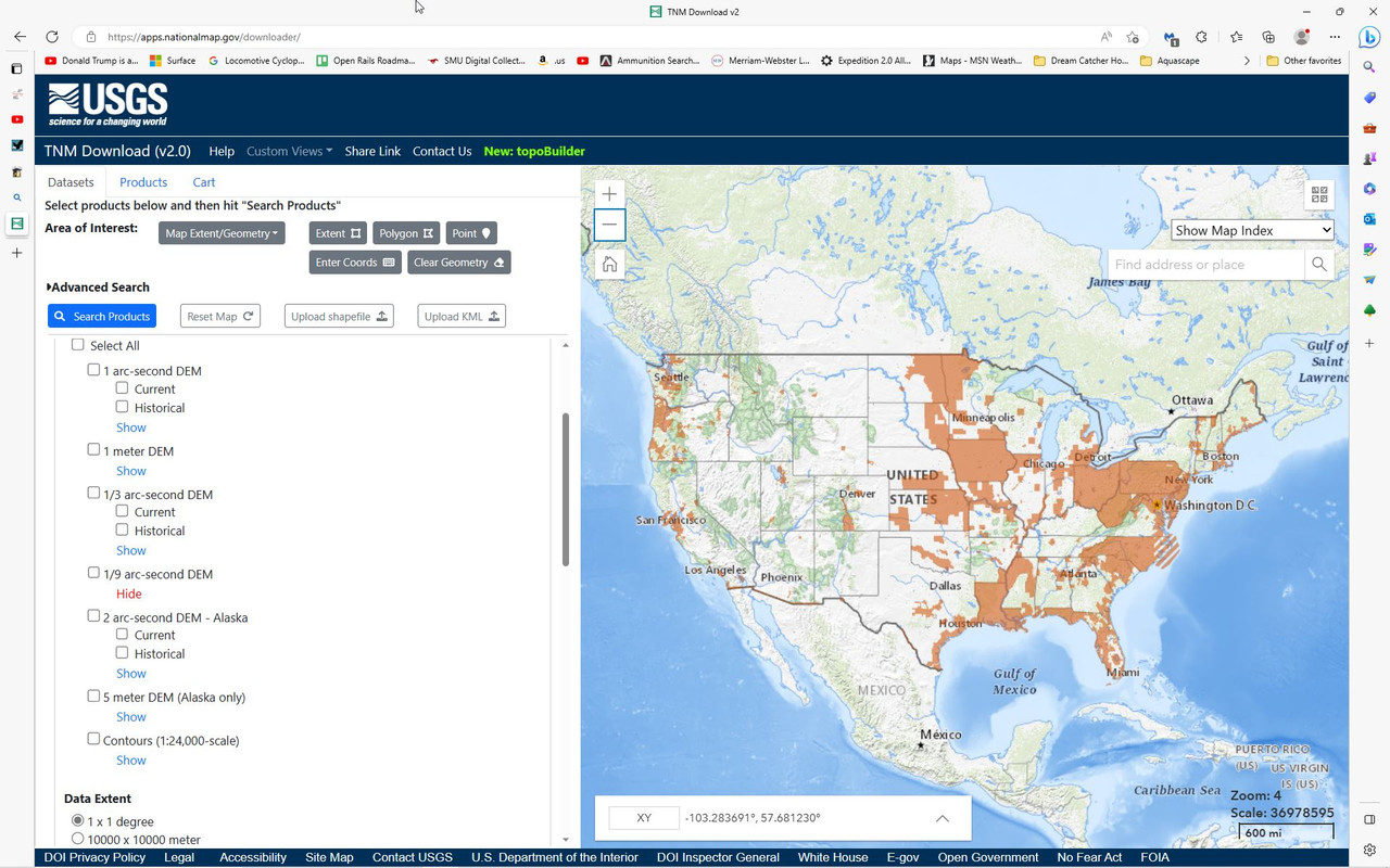
I just downloaded a few DEM files from the USGS as a test, and its working fine for me. They have changed the URL link, and the user interface slightly from the time of the last tutorial I wrote. I'll update it for the changes. The link you should be using for the viewer/downloader is: https://apps.nationalmap.gov/downloader/#/
kris120 wrote:Try http://viewfinderpanoramas.org/Coverage ... s_org3.htm
They don't have exactly the same files like usgs, but quality is the same or better.
No.
The quality is not even close to comparable for the United States and Canada.
Most of the US data from that site is 3 arc second resolution. This is not even worth using for even rudimentary route creation. 3 arc second builds the terrain based on plot points every 90 meters/yards. I was helping a user on here some years ago who was working on a route that included Abo Canyon, in New Mexico. He had originally used 3 arc second DEM/SRTM from the Viewfinder Panoramas site for the route. The jagged rocks and chasms in that area looked like a series of shallow rolling sand dunes in the game because of the DEM resolution. The site does have some 1 arc second data for some parts of Europe though.
An easy way to gauge the resolution of the DEM is the size of the file in the download. For a full lat/long grid square, the 3 arc second files from Viewfinder are 2.8MB. A 1 arc second file (3 times more accurate) for the same area should be between 30 to 50MB. The same area again in 1/3 arc second (3x more accurate that 1 arc second and 9x than 3 arc second) would have a 350MB-450MB file size.
The only upside to the data from the Viewfinder site is that it is already in the " .hgt " file format for Railworks. My recommendation to anyone serious about building a prototypical route though, is to get the data from the USGS site, and follow the simple tutorial from Kevin @ Searchlight Simulations, which is referenced and linked to from numerous threads on this forum.
Searchlight Simulations
https://www.store.searchlight-simulations.com/
https://www.store.searchlight-simulations.com/
-

BoostedFridge - Posts: 2277
- Joined: Sat Aug 24, 2013 6:39 am
- Location: Vancouver, BC
Re: US SRTM DEM Data
![]() by wlenz781 » Sun Feb 14, 2021 11:28 pm
by wlenz781 » Sun Feb 14, 2021 11:28 pm
"The only upside to the data from the Viewfinder site is that it is already in the " .hgt " file format for Railworks."
That was why I liked the page that I link in my "op". It also had a directory of 25MB hgt files for the entire US in easy to download links. Just select the Long/Lat and download the file and save it in your DEM/SRTM folder.
That was why I liked the page that I link in my "op". It also had a directory of 25MB hgt files for the entire US in easy to download links. Just select the Long/Lat and download the file and save it in your DEM/SRTM folder.
- wlenz781
- Posts: 306
- Joined: Wed Dec 14, 2016 5:15 pm
- Location: Joplin, Missouri
Re: US SRTM DEM Data
![]() by BoostedFridge » Mon Feb 15, 2021 1:35 am
by BoostedFridge » Mon Feb 15, 2021 1:35 am
My offer still stands regarding the 1/9 arc second terrain. If you can put together the marker file, I'm happy to do the rest.
Searchlight Simulations
https://www.store.searchlight-simulations.com/
https://www.store.searchlight-simulations.com/
-
BoostedFridge - Posts: 2277
- Joined: Sat Aug 24, 2013 6:39 am
- Location: Vancouver, BC
Re: US SRTM DEM Data
![]() by wlenz781 » Mon Feb 15, 2021 10:46 am
by wlenz781 » Mon Feb 15, 2021 10:46 am
I am still trying to get back to my route building for the KCS line and will take you up on that offer.
In the meantime, I did find another source that has global 1-arc second hgt files. You can download for anywhere in the world from this map. It requires a free registration with NASA. The whole world is broke up in grids and each block is 1 degree x 1 degree and is a 25MB file. These files can be dropped straight from their zip file into Railworks with no conversion necessary.
https://dwtkns.com/srtm30m/
- wlenz781
- Posts: 306
- Joined: Wed Dec 14, 2016 5:15 pm
- Location: Joplin, Missouri
Re: US SRTM DEM Data
![]() by buzz456 » Tue Feb 16, 2021 8:46 am
by buzz456 » Tue Feb 16, 2021 8:46 am
BoostedFridge wrote:My offer still stands regarding the 1/9 arc second terrain. If you can put together the marker file, I'm happy to do the rest.
I think I'm late to the party here but what are you referring to as the "marker file"?
Buzz
39 and holding.
"Some people find fault like there's a reward for it."- Zig Ziglar
"If you can dream it you can do it."- Walt Disney
39 and holding.
"Some people find fault like there's a reward for it."- Zig Ziglar
"If you can dream it you can do it."- Walt Disney
-
buzz456 - Site Admin
- Posts: 21391
- Joined: Sun Mar 21, 2010 8:30 am
- Location: SW Florida
Re: US SRTM DEM Data
![]() by wlenz781 » Tue Feb 16, 2021 10:34 am
by wlenz781 » Tue Feb 16, 2021 10:34 am
It was an offer to get 1/3-arc second data for a US route of the KCS that I am planning on working on. I really need to get back to it. The route markers are in Google Earth at 7 mile intervals so that ReDEM can extract the data and convert it to Railworks for me.
- wlenz781
- Posts: 306
- Joined: Wed Dec 14, 2016 5:15 pm
- Location: Joplin, Missouri
Re: US SRTM DEM Data
![]() by buzz456 » Tue Feb 16, 2021 12:34 pm
by buzz456 » Tue Feb 16, 2021 12:34 pm
wlenz781 wrote:It was an offer to get 1/3-arc second data for a US route of the KCS that I am planning on working on. I really need to get back to it. The route markers are in Google Earth at 7 mile intervals so that ReDEM can extract the data and convert it to Railworks for me.
I'm looking at Google Earth and I don't see any markers on the maps. I am going to take Boosted up on his offer if I can figure out what to tell him.
Buzz
39 and holding.
"Some people find fault like there's a reward for it."- Zig Ziglar
"If you can dream it you can do it."- Walt Disney
39 and holding.
"Some people find fault like there's a reward for it."- Zig Ziglar
"If you can dream it you can do it."- Walt Disney
-
buzz456 - Site Admin
- Posts: 21391
- Joined: Sun Mar 21, 2010 8:30 am
- Location: SW Florida
Re: US SRTM DEM Data
![]() by TheTeenageFoamer » Sat Feb 20, 2021 7:04 pm
by TheTeenageFoamer » Sat Feb 20, 2021 7:04 pm
buzz456 wrote:I'm looking at Google Earth and I don't see any markers on the maps. I am going to take Boosted up on his offer if I can figure out what to tell him.
I'm a little late the party myself, but the markers are manually placed in Google earth approx. 7 miles apart. The markers locations will allow you to copy coordinates to create the files ReDem needs to generate the terrain bins for the route.
This is an example of the markers in GE I had to place for my route:
then you take the coordinates of the markers and make a .csv file to use in ReDem.
You do not have the required permissions to view the files attached to this post.
-TheTeenageFoamer
-

TheTeenageFoamer - Posts: 783
- Joined: Sun Oct 18, 2015 1:37 pm
Re: US SRTM DEM Data
![]() by buzz456 » Sat Feb 20, 2021 8:31 pm
by buzz456 » Sat Feb 20, 2021 8:31 pm
So how far away from the track does that get you? Another one of these I saw had markers out to the side a ways also. Just asking before I do this exercise.
Buzz
39 and holding.
"Some people find fault like there's a reward for it."- Zig Ziglar
"If you can dream it you can do it."- Walt Disney
39 and holding.
"Some people find fault like there's a reward for it."- Zig Ziglar
"If you can dream it you can do it."- Walt Disney
-
buzz456 - Site Admin
- Posts: 21391
- Joined: Sun Mar 21, 2010 8:30 am
- Location: SW Florida
Re: US SRTM DEM Data
![]() by BoostedFridge » Sat Feb 20, 2021 9:33 pm
by BoostedFridge » Sat Feb 20, 2021 9:33 pm
buzz456 wrote:So how far away from the track does that get you? Another one of these I saw had markers out to the side a ways also. Just asking before I do this exercise.
If you set your 'range' setting in Redem to maximum (10), then the program will generate tiles in a square shape approximately 7 miles by 7 miles, centered on each marker coordinate. You want the terrain generated by each marker to overlap the next, which will give you continuous uninterrupted terrain. See the example below from my Siskyou route:
The red line is the railroad. The green squares are centered around each marker location. I try to have each marker correspond to a station, siding, or control point so that the same markers can be used for quick navigation in the editor, and for scenario start locations. Note in the instance of Grants Pass, that I had to make a marker on each side of town instead of one at the actual station location, in order to have the DEM coverage be continuous to the next marker/station locations.
Now this method is fine for generating high resolution DEM to lay your track on. In order to take advantage of distant terrain, and not having the 'edge of the world' potentially within sight of your line, you would also need to generate and import some lower resolution terrain (I use 1 arc second) around the edge of your high res DEM.
An alternative method, which is a fair bit more time consuming is to run additional 'rows' of markers paralleling the rail line on each side. With proper placement you can get just over 10 miles of uninterrupted terrain on either side of the line. I also use this method when generating junction areas between intersecting lines, or in large city areas. The method takes more time because of the sheer number of markers to place, and then copying their lat/long coordinates into your csv file for Redem. The actual tile generation process in Redem is quite long to start with, and also gets significantly longer when you're generating all of these additional tiles. It is worth noting if you are going to use this method, that Redem gets kind of buggy/unstable when trying to process marker files with a lot of lines. When I did the MRL terrain, I had to split the 220 markers into three different files to process seperately in order to get it to work.
In the example above, I have set markers on the highest mountain peaks on each side of the canyon surrounding the mainlines. This way when I generated my distant terrain, the silhouettes of the distant mountains were all complete, and formed a continuous ridgeline visible from the tracks.
You do not have the required permissions to view the files attached to this post.
Searchlight Simulations
https://www.store.searchlight-simulations.com/
https://www.store.searchlight-simulations.com/
-
BoostedFridge - Posts: 2277
- Joined: Sat Aug 24, 2013 6:39 am
- Location: Vancouver, BC
Re: US SRTM DEM Data
![]() by pkz19 » Fri Apr 21, 2023 1:33 pm
by pkz19 » Fri Apr 21, 2023 1:33 pm
BoostedFridge wrote:My offer still stands regarding the 1/9 arc second terrain. If you can put together the marker file, I'm happy to do the rest.
Sorry to revive an old thread but does this offer still stand? I spent several hours yesterday trying to get USGS .tif data converted to .hgt and finally gave up at 1 in the morning
- pkz19
- Posts: 319
- Joined: Sun Mar 08, 2015 5:41 pm
Re: US SRTM DEM Data
![]() by scottb613 » Fri Apr 21, 2023 5:33 pm
by scottb613 » Fri Apr 21, 2023 5:33 pm
Hi Folks,
Isn't 1/9 Arc Second Data still only very limited coverage?
Regards,
Scott
Isn't 1/9 Arc Second Data still only very limited coverage?
Regards,
Scott

-

scottb613 - Posts: 82
- Joined: Tue Jan 08, 2019 6:49 am
- Location: Downeast Maine (soon)
16 posts
• Page 1 of 2 • 1, 2
Who is online
Users browsing this forum: No registered users and 33 guests