
Has anyone ever done anything or thought about doing something featuring Stampede Pass?
https://en.wikipedia.org/wiki/Stampede_Pass
Stampede Pass
First unread post • 12 posts
• Page 1 of 1
Stampede Pass
 by buzz456 » Sat Jan 06, 2018 10:24 am
Buzz
39 and holding.
"Some people find fault like there's a reward for it."- Zig Ziglar
"If you can dream it you can do it."- Walt Disney
39 and holding.
"Some people find fault like there's a reward for it."- Zig Ziglar
"If you can dream it you can do it."- Walt Disney
-

buzz456 - Site Admin
- Posts: 21410
- Joined: Sun Mar 21, 2010 8:30 am
- Location: SW Florida
Re: Stampede Pass
by PNWR1854 » Sat Jan 06, 2018 10:52 am
I was at it several years ago, but my computer crashed completely, corrupting the files. (Or at least when I tried to open them, railworks crashed.) And on my new computer, it does not show up. If we could build a team and work on it that would be better, my idea is we could have several people on scenery, a person on buildings, 2 people on trackwork, etc...
- PNWR1854
- Posts: 525
- Joined: Sat Dec 02, 2017 7:43 pm
- Location: Pacific Northwest
Re: Stampede Pass
by ErikGorbiHamilton » Sat Jan 06, 2018 3:21 pm
I was thinking about it but my patience has other plans 
Would be a neat run though. Would someone make a 1970's version with early BN or would someone make a present day route?
IIRC BoostedFridge does have an interest but is busy with the Siskiyou.
Would be a neat run though. Would someone make a 1970's version with early BN or would someone make a present day route?
IIRC BoostedFridge does have an interest but is busy with the Siskiyou.
-

ErikGorbiHamilton - Posts: 1574
- Joined: Fri Aug 23, 2013 2:41 pm
Re: Stampede Pass
by ET44C4 » Sat Jan 06, 2018 3:24 pm
ErikGorbiHamilton wrote:Would someone make a 1970's version with early BN or would someone make a present day route?
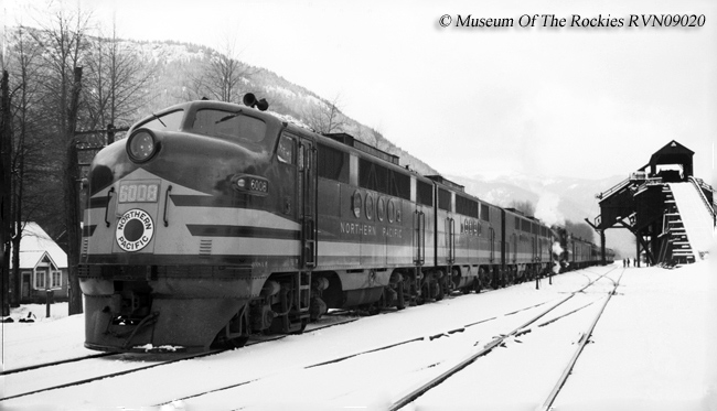
My vote will always be an older version of anything. Northern Pacific

**Not taking any requests**
Santa Fe All The Way
Nothing Runs Like a Deere
No Farms No Food
Ford Powerstroke
My 87 Ford: https://www.youtube.com/channel/UCvNRba ... _tNs53k42w
Santa Fe All The Way
Nothing Runs Like a Deere
No Farms No Food
Ford Powerstroke
My 87 Ford: https://www.youtube.com/channel/UCvNRba ... _tNs53k42w
-

ET44C4 - Posts: 3187
- Joined: Mon Aug 22, 2016 12:01 pm
- Location: Clover, South Carolina
Re: Stampede Pass
by buzz456 » Sat Jan 06, 2018 3:46 pm
What ET said. Also without going nuts and making a zillion mile long route what's a good start and stop point?
Buzz
39 and holding.
"Some people find fault like there's a reward for it."- Zig Ziglar
"If you can dream it you can do it."- Walt Disney
39 and holding.
"Some people find fault like there's a reward for it."- Zig Ziglar
"If you can dream it you can do it."- Walt Disney
-
buzz456 - Site Admin
- Posts: 21410
- Joined: Sun Mar 21, 2010 8:30 am
- Location: SW Florida
Re: Stampede Pass
by ErikGorbiHamilton » Sat Jan 06, 2018 3:52 pm
buzz456 wrote:What ET said. Also without going nuts and making a zillion mile long route what's a good start and stop point?
Auburn Yard to Ellensburg is traditional. Used to be a a crew that ran trains from Auburn to Ellensburg on a pool but that pool has since been abolished with the implementation of the "Triangle". Pasco would be a neat extension going through the Yakima River Canyon, but would be a really long run.
The Stampede Sub is also one of the last holdouts for a jointed rail mainline, so if this route is made that has to be emulated otherwise it wouldn't feel the same

-
ErikGorbiHamilton - Posts: 1574
- Joined: Fri Aug 23, 2013 2:41 pm
Re: Stampede Pass
by buzz456 » Sat Jan 06, 2018 3:53 pm
Any idea how many miles we're talking here?
Buzz
39 and holding.
"Some people find fault like there's a reward for it."- Zig Ziglar
"If you can dream it you can do it."- Walt Disney
39 and holding.
"Some people find fault like there's a reward for it."- Zig Ziglar
"If you can dream it you can do it."- Walt Disney
-
buzz456 - Site Admin
- Posts: 21410
- Joined: Sun Mar 21, 2010 8:30 am
- Location: SW Florida
Re: Stampede Pass
by ErikGorbiHamilton » Sat Jan 06, 2018 4:16 pm
buzz456 wrote:Any idea how many miles we're talking here?
From what my father says it's Auburn to Ellensburg is 102.9 miles. East of Ellensburg it becomes the "Yakima Valley Subdivision". That runs from Ellensburg to SP&S Junction in Pasco. From Ellensburg to Pasco it's 127 miles. Combined subdivision length would be 229.9 miles.
-
ErikGorbiHamilton - Posts: 1574
- Joined: Fri Aug 23, 2013 2:41 pm
Re: Stampede Pass
by buzz456 » Sat Jan 06, 2018 5:44 pm
A hundred miles or thereabouts is a big job for any route. You can always go on when you get that done. Large towns are the time killer and you would have a couple of them. I know a super terrain and track layer guy if you could talk him into doing it. We are trying to get the first chunk of the MRL done so we can put it out there. It's amazing how the details take so much time...............
Buzz
39 and holding.
"Some people find fault like there's a reward for it."- Zig Ziglar
"If you can dream it you can do it."- Walt Disney
39 and holding.
"Some people find fault like there's a reward for it."- Zig Ziglar
"If you can dream it you can do it."- Walt Disney
-
buzz456 - Site Admin
- Posts: 21410
- Joined: Sun Mar 21, 2010 8:30 am
- Location: SW Florida
Re: Stampede Pass
by ET44C4 » Sat Jan 06, 2018 6:25 pm
I'm slowly doing the NS Norfolk District and it took me multiple days just to do a couple miles... Route building is for those who have good amounts of patients... and coffee... 
**Not taking any requests**
Santa Fe All The Way
Nothing Runs Like a Deere
No Farms No Food
Ford Powerstroke
My 87 Ford: https://www.youtube.com/channel/UCvNRba ... _tNs53k42w
Santa Fe All The Way
Nothing Runs Like a Deere
No Farms No Food
Ford Powerstroke
My 87 Ford: https://www.youtube.com/channel/UCvNRba ... _tNs53k42w
-
ET44C4 - Posts: 3187
- Joined: Mon Aug 22, 2016 12:01 pm
- Location: Clover, South Carolina
Re: Stampede Pass
by BoostedFridge » Sun Jan 07, 2018 3:09 am
I generated all of the 1/3 arc second DEM, and marker files for Stampede Pass AND Snoqualmie Pass which was the MILW road route just to the north of Stampede. The NP and MILW were literally side by side for most of the miles east of the summits. I think I did all the DEM for Tacoma to Othello, and Auburn to Yakima. I had dreamed of making the route after I was done with the Siskiyou, before I realized how much of an undertaking I had bitten off with that route.
Auburn to Ellensburg would be the natural portion of the NP/BN/BNSF route to model, but Auburn to Cle Elum (~80 miles) would get the complete pass, as well as the logging branches to Roslyn & Ronald for switching opportunities. The only major difference in the route between NP days and modern operation is that the west side of the pass was double tracked under the NP.
The nearby MILW route was arguably the more scenic with 6 high trestles, and huge snowsheds, but would be quite the undertaking on its own.
I also have all the MILW track charts, and BNSF track charts for the route(s), as well as a collection of images of the structures on the line.
I would be happy to send the files to an individual or group SERIOUSLY interested in taking it on.
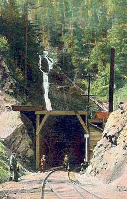
Below are some photos of the route in its 'mothballed' state in the 90's, as well as after the BNSF resuscitation of the line in 1996. Photos copyright their respective owners.
Auburn to Ellensburg would be the natural portion of the NP/BN/BNSF route to model, but Auburn to Cle Elum (~80 miles) would get the complete pass, as well as the logging branches to Roslyn & Ronald for switching opportunities. The only major difference in the route between NP days and modern operation is that the west side of the pass was double tracked under the NP.
The nearby MILW route was arguably the more scenic with 6 high trestles, and huge snowsheds, but would be quite the undertaking on its own.
I also have all the MILW track charts, and BNSF track charts for the route(s), as well as a collection of images of the structures on the line.
I would be happy to send the files to an individual or group SERIOUSLY interested in taking it on.
Below are some photos of the route in its 'mothballed' state in the 90's, as well as after the BNSF resuscitation of the line in 1996. Photos copyright their respective owners.
You do not have the required permissions to view the files attached to this post.
Searchlight Simulations
https://www.store.searchlight-simulations.com/
https://www.store.searchlight-simulations.com/
-

BoostedFridge - Posts: 2277
- Joined: Sat Aug 24, 2013 6:39 am
- Location: Vancouver, BC
Re: Stampede Pass
by jpetersjr » Wed Jan 10, 2018 4:05 pm

I think this would be a good route for later, I could make some custom buildings for it when I have the time such as I've been doing for the Big Sky.



Jonathan Burton Peters Jr, Big J
The Legend Of The New York Central System Shall Live Again In TS2021.
Website
https://jpetersjr1.wixsite.com/big-j-productions
3D Freeware Scenery Developer Since 2011
The Legend Of The New York Central System Shall Live Again In TS2021.
Website
https://jpetersjr1.wixsite.com/big-j-productions
3D Freeware Scenery Developer Since 2011
-

jpetersjr - Posts: 4010
- Joined: Tue Apr 26, 2011 6:31 pm
- Location: Mobile, Alabama, United States,
12 posts
• Page 1 of 1
Who is online
Users browsing this forum: No registered users and 41 guests