Thanks for your help Kana
_o_OOOO_oo-Kanawha wrote:Well, most actual stations, cabins etc. have long since been torn down. Many names on the map are nothing more than named signs or signalling cabinets.
I know, but wouldn't it be nice that you can relate to place in the real world. For instance using google maps to display the route
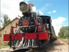
"A" cabin still stands at Alleghany, Va., check Tori's web pages for her latest photos with it.
Did not find any on Toti's website. But I did find this one on google maps at Alleghany (took me over 3 hrs to find it)
I added a screen shot for comparison
Alleghany.jpg
There is free US topographic maps available online, you can look for older maps from say the fifties, when most stations and cabins were stilled manned.
There are track charts etc. available from cohs.org to help you research as well, but in our modern age Google Earth discloses everything much better. It now has a timeline feature, you can jump back a few years to compare.
Google eart is nice and easy. Tracking the C&O route I even stumbled upon various trains

Otherwise use Google Maps to create some GPS markers you can load into your phone or tablet and use its GPS to point you. Provided you have GPS coverage on the Cardinal of course.
Great idea, too bad I do not have a GPS phone.
You do not have the required permissions to view the files attached to this post.
ASUS Laptop Zenbook Pro 14 - Intel Core i9 13900H - 32 GB RAM - 1 TB SSD - 8 GB NVIDIA GeForce RTX 4060 GPU - Win11 64 Home - 14.5" Screen @ 2880 x 1800 - Graphics @ HIGH. Having a great time running tough American diesels!
Currently running - TSC 2024 v77.6b