I've been working on bringing the Southern Pacific Siskiyou Line to TS2015 for the last several months. This little known 'branchline' was once the primary route linking Portland and the pacific northwest with California. After the Completion of the Natron Cutoff (Willamette Pass) in 1926, most through traffic was rerouted off of the Siskiyou Line. This downgrade to branchline status led to the line being passed over for many modern improvements over the years such as CTC, ribbon rail, and modern signals. The line was far from inactive though; over 80% of the wood products carloads on the entire Southern Pacific system originated from industries on this route. Despite all of this, amid financial turmoil in 1994 SP sold the line to shortline operator RailAmerica who began operation as the Central Oregon & Pacific.
I chose this route in part because of the operational challenges it poses. The line featured the steepest grade on the SP network; a torturous 3.67% climb 'eastbound' for almost 5 miles to Siskiyou summit, followed immediately by a 3.4% plunge down the 'east' side of the mountains to Ashland. There are no less than nine separate hills to climb over the course of the route. The line is not all slow mountain railroading though. The track speed jumps to 40mph through the verdant Shasta Valley, and Rogue River Valley. There are over 25 online industries for the switching enthusiasts out there, as well as small classification yards in the industrial centers of Medford, Grants Pass, and Roseburg.
Manned helpers ran the length of the line, either midtrain on "westbounds", or on the headend of returning "eastbounds". Veteran first generation EMD power was a staple of the line from the the 1960's through the end of SP operation. Although traffic has varied through the years, at least 2-4 road freights traversed the line daily, with 6 local road-switching jobs based at various points along the route. Due to a lack of 'modern' talking hotbox detectors, cabooses were used right through the end of SP operation. The entire route used US&S lower quadrant semaphores through the early 1980's, and still had at least half of them in use when SP sold the line in 1994.
This route is based loosely between 1980 and 1992. Most of the assets would allow it to be an earlier era, except for some of the cars, trucks, and industrial buildings. My 3d modeling is absolute crap, so some of the custom mill structures that I will need to make will be my biggest challenge.
I have laid all 265 miles of mainline trackage, plus yards and branchlines, and some bonus track of the SP mainline. The terrain is 1/3 arc second DEM, and has been adjusted/massaged for about 90% of the route to its final positioning. Scenery started slow, but is now progressing at a decent pace. I am into the route for about 450 hours so far, and estimate there will be another 1000-1200 hours before it is complete to my level of satisfaction. I know that I've taken on quite a lot with a route of this size, but I couldn't bring myself to 'cut the route short' to any specific section. I will update this thread with pictures of progress, as different milestones are reached.
Payware Required:
US Loco & Asset Pack (for post TS2012 users)
Donner Pass
RWA Lakeside Route
Freeware Required:
RCAP v2 (RWA)
Girder Bridge Set (Golden Age of Railroading)
ScaleRail (3dTrains)
ScaleRoad (3dTrains)
Rural Landscapes (3dTrains)
NRD Warehouse 5 Pack (John Lippai - RWA)
NRD Trestle Pack (John Lippai - RWA)
NRD Commercial & Industrial Buildings Pack 1 (John Lippai - RWA)
NRD House Pack 1 (John Lippai - RWA)
NRD House Pack 2 (John Lippai - RWA)
Barns & Silos (Peter Bauer - RWA)
Black Butte - Montague
Hornbrook - Ashland
Medford
The Siskiyou Line
The Siskiyou Line
![]() by BoostedFridge » Tue Mar 17, 2015 3:54 am
by BoostedFridge » Tue Mar 17, 2015 3:54 am
You do not have the required permissions to view the files attached to this post.
Last edited by BoostedFridge on Tue Dec 06, 2016 4:17 am, edited 4 times in total.
Searchlight Simulations
https://www.store.searchlight-simulations.com/
https://www.store.searchlight-simulations.com/
-

BoostedFridge - Posts: 2277
- Joined: Sat Aug 24, 2013 6:39 am
- Location: Vancouver, BC
Re: The Siskiyou Line
![]() by BoostedFridge » Tue Mar 17, 2015 3:56 am
by BoostedFridge » Tue Mar 17, 2015 3:56 am
You do not have the required permissions to view the files attached to this post.
Searchlight Simulations
https://www.store.searchlight-simulations.com/
https://www.store.searchlight-simulations.com/
-
BoostedFridge - Posts: 2277
- Joined: Sat Aug 24, 2013 6:39 am
- Location: Vancouver, BC
Re: The Siskiyou Line
![]() by KPryor » Tue Mar 17, 2015 5:21 am
by KPryor » Tue Mar 17, 2015 5:21 am
Your work so far looks amazing. You've definitely picked what sounds like a really neat route to do and your description of it all was very interesting.
Ken
Ken
Ken Pryor
I went to prison for murder.....but I stayed for the chili!
I went to prison for murder.....but I stayed for the chili!
- KPryor
- Posts: 117
- Joined: Thu Mar 12, 2015 7:56 pm
- Location: Flat Rock, Illinois
Re: The Siskiyou Line
![]() by Bananarama » Tue Mar 17, 2015 7:05 am
by Bananarama » Tue Mar 17, 2015 7:05 am
I agree with Ken and it looks like a winner to me! 

-

Bananarama - Posts: 2749
- Joined: Sat Feb 14, 2009 1:17 am
- Location: Another Planet
Re: The Siskiyou Line
![]() by Chacal » Tue Mar 17, 2015 11:42 am
by Chacal » Tue Mar 17, 2015 11:42 am
This could become my favorite route!

Over the hill and gathering speed
- Chacal
- Site Admin
- Posts: 6476
- Joined: Tue Jul 05, 2011 1:11 pm
- Location: Quebec, Canada
Re: The Siskiyou Line
![]() by ErikGorbiHamilton » Tue Mar 17, 2015 6:27 pm
by ErikGorbiHamilton » Tue Mar 17, 2015 6:27 pm
Are those trees and textures from donner pass? or is it just the rolling stock?
-

ErikGorbiHamilton - Posts: 1580
- Joined: Fri Aug 23, 2013 2:41 pm
Re: The Siskiyou Line
![]() by BoostedFridge » Tue Mar 17, 2015 6:48 pm
by BoostedFridge » Tue Mar 17, 2015 6:48 pm
BNOV2 wrote:Are those trees and textures from donner pass? or is it just the rolling stock?
Most of what I've used is Donner Pass, or the 'default' US Asset pack, but there are scenery items from the other sources I've listed also.
As far as rolling stock goes, with the route will be several scenarios utilizing only Donner Pass & freeware assets. I will also release more scenarios utilizing other payware DLC notably the SD45, and other more 'advanced' freeware.
Searchlight Simulations
https://www.store.searchlight-simulations.com/
https://www.store.searchlight-simulations.com/
-
BoostedFridge - Posts: 2277
- Joined: Sat Aug 24, 2013 6:39 am
- Location: Vancouver, BC
Re: The Siskiyou Line
![]() by KPryor » Tue Mar 17, 2015 9:24 pm
by KPryor » Tue Mar 17, 2015 9:24 pm
Note to self: Buy Donner Pass so I can enjoy this route when it's available.
Ken Pryor
I went to prison for murder.....but I stayed for the chili!
I went to prison for murder.....but I stayed for the chili!
- KPryor
- Posts: 117
- Joined: Thu Mar 12, 2015 7:56 pm
- Location: Flat Rock, Illinois
Re: The Siskiyou Line
![]() by BoostedFridge » Tue Mar 17, 2015 9:58 pm
by BoostedFridge » Tue Mar 17, 2015 9:58 pm
Thanks for the compliment Ken. You have lots of time, so wait for a sale on it 
Searchlight Simulations
https://www.store.searchlight-simulations.com/
https://www.store.searchlight-simulations.com/
-
BoostedFridge - Posts: 2277
- Joined: Sat Aug 24, 2013 6:39 am
- Location: Vancouver, BC
Re: The Siskiyou Line
![]() by MadMike1024 » Tue Mar 17, 2015 10:50 pm
by MadMike1024 » Tue Mar 17, 2015 10:50 pm
That gaggle of switchbacks from Ashland, OR to the Sisiyou summit are a railroaders nightmare. FYI, the last time I went that way (2010 IIRC) there were many of the semaphores still standing, although none were live. For a period of time, the tunnel at the summit was unusable because of a fire that damaged several of the timber supports.
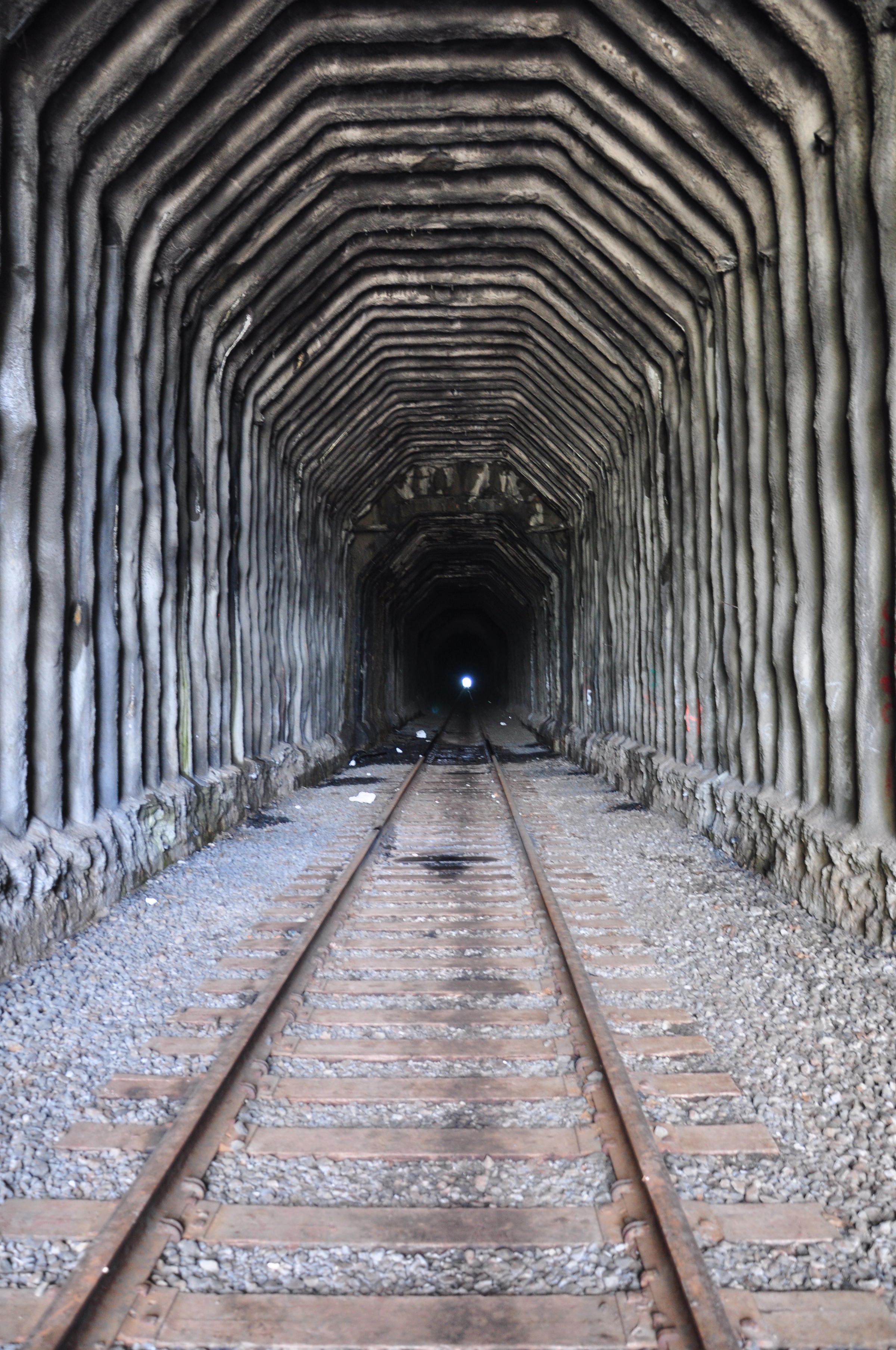
Currently, the tunnel is back in use. I'm glad to see the line being built in Railworks.
Currently, the tunnel is back in use. I'm glad to see the line being built in Railworks.
- MadMike1024
- Global Mod
- Posts: 1757
- Joined: Fri Jul 30, 2010 8:11 pm
- Location: Vancouver, WA
Re: The Siskiyou Line
![]() by gtrtroger » Wed Mar 18, 2015 8:19 am
by gtrtroger » Wed Mar 18, 2015 8:19 am
250+ miles of Espee goodness.....
Looking forward to climbing the Siskiyou...
Looking forward to climbing the Siskiyou...
-

gtrtroger - Posts: 1240
- Joined: Mon Jun 30, 2014 7:31 am
- Location: Montgomery, Alabama
Re: The Siskiyou Line
![]() by dr1980 » Thu Mar 19, 2015 4:35 pm
by dr1980 » Thu Mar 19, 2015 4:35 pm
Sounds like a really interesting route, looking forward to following the progress on this one!
- dr1980
- Posts: 376
- Joined: Fri Oct 11, 2013 8:05 pm
- Location: Canada
Re: The Siskiyou Line
![]() by BoostedFridge » Fri Mar 20, 2015 1:50 am
by BoostedFridge » Fri Mar 20, 2015 1:50 am
I've been working on scenery between Hugo and Leland this week. I have a 4 mile section about 80% complete. A bit more foliage and some terrain painting before its done...
You do not have the required permissions to view the files attached to this post.
Searchlight Simulations
https://www.store.searchlight-simulations.com/
https://www.store.searchlight-simulations.com/
-
BoostedFridge - Posts: 2277
- Joined: Sat Aug 24, 2013 6:39 am
- Location: Vancouver, BC
Who is online
Users browsing this forum: No registered users and 1 guest