 So this time around I will be starting from the Clovis side and work my way up to Belen NM, I will be posting WIP pictures here every now and then to keep people posted like on the last forum
BNSF Clovis Sub Take 2
BNSF Clovis Sub Take 2
![]() by stationmaster101 » Fri Feb 27, 2015 5:09 pm
by stationmaster101 » Fri Feb 27, 2015 5:09 pm
Alright so, after finishing the BNSF Belen yard and everything my computer thought it was a brilliant idea to do a factory reset, basically meaning I lost everything. So this time around I will be starting from the Clovis side and work my way up to Belen NM, I will be posting WIP pictures here every now and then to keep people posted like on the last forum
So this time around I will be starting from the Clovis side and work my way up to Belen NM, I will be posting WIP pictures here every now and then to keep people posted like on the last forumStationmaster
-

stationmaster101 - Posts: 134
- Joined: Tue Oct 07, 2014 6:37 pm
Re: BNSF Clovis Sub Take 2
![]() by stationmaster101 » Fri Feb 27, 2015 10:25 pm
by stationmaster101 » Fri Feb 27, 2015 10:25 pm
Well got the track work between Farewell Tx to Clovis done, now my main focus is the Clovis yard itself.
Map so far

Farwell Wye


Entering Clovis NM

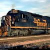
Clovis Yard WIP

Map so far
Farwell Wye
Entering Clovis NM
Clovis Yard WIP
Stationmaster
-
stationmaster101 - Posts: 134
- Joined: Tue Oct 07, 2014 6:37 pm
Re: BNSF Clovis Sub Take 2
![]() by imnew » Sat Feb 28, 2015 3:01 am
by imnew » Sat Feb 28, 2015 3:01 am
Oh man..  Don't you have any backups? I backup my wip route after every session ( external drive ) .
Anyways, good to see you are back at it.!
Anyways, good to see you are back at it.!
Intel Core I7-7770K, ZOTAC GTX 1080 Ti AMP
Extreme, ASUS ROG Strix Z270H, 16 GB HyperX Fury DDR4, Samsung 850 EVO 500GB, Corsair Force MP500 240GB M.2, 34" Ultra Wide Samsung Monitor
Extreme, ASUS ROG Strix Z270H, 16 GB HyperX Fury DDR4, Samsung 850 EVO 500GB, Corsair Force MP500 240GB M.2, 34" Ultra Wide Samsung Monitor
-
imnew - Posts: 2456
- Joined: Tue Aug 25, 2009 1:41 pm
Re: BNSF Clovis Sub Take 2
![]() by stationmaster101 » Sun Mar 01, 2015 11:09 pm
by stationmaster101 » Sun Mar 01, 2015 11:09 pm
The Clovis yard is finally finished! now i just need help deciding if i should move on with the track work only or start working on the scenery.
Stationmaster
-
stationmaster101 - Posts: 134
- Joined: Tue Oct 07, 2014 6:37 pm
Re: BNSF Clovis Sub Take 2
![]() by BoostedFridge » Mon Mar 02, 2015 2:02 am
by BoostedFridge » Mon Mar 02, 2015 2:02 am
Good on you for rolling with the punches, and getting right back to the route!
Searchlight Simulations
https://www.store.searchlight-simulations.com/
https://www.store.searchlight-simulations.com/
-

BoostedFridge - Posts: 2277
- Joined: Sat Aug 24, 2013 6:39 am
- Location: Vancouver, BC
Re: BNSF Clovis Sub Take 2
![]() by stationmaster101 » Thu Mar 05, 2015 8:05 pm
by stationmaster101 » Thu Mar 05, 2015 8:05 pm
So i've gotten about a 5-6 miles outside of clovis when i've ran into a problem, I have to start work on the grades from here on up the pass and all i have to do that with is the magnet tool, so i was wondering if there was a quicker and easier way then just setting the magnet tool to a certain distance and using the brush to fill it in (i've done this with it set up to 1,000 meters on both sides of the track but it takes an hour to fill in about 2 miles worth of track)


This yard is the old abandoned Cannon Air Force Base transfer yard.
This yard is the old abandoned Cannon Air Force Base transfer yard.
Stationmaster
-
stationmaster101 - Posts: 134
- Joined: Tue Oct 07, 2014 6:37 pm
Re: BNSF Clovis Sub Take 2
![]() by BoostedFridge » Thu Mar 05, 2015 10:56 pm
by BoostedFridge » Thu Mar 05, 2015 10:56 pm
stationmaster101 wrote:So i've gotten about a 5-6 miles outside of clovis when i've ran into a problem, I have to start work on the grades from here on up the pass and all i have to do that with is the magnet tool, so i was wondering if there was a quicker and easier way then just setting the magnet tool to a certain distance and using the brush to fill it in (i've done this with it set up to 1,000 meters on both sides of the track but it takes an hour to fill in about 2 miles worth of track)
I might be misreading this, or missing something, but are you laying the track based on a grade profile/track chart, then snapping the terrain to the 'floating' track?
Searchlight Simulations
https://www.store.searchlight-simulations.com/
https://www.store.searchlight-simulations.com/
-
BoostedFridge - Posts: 2277
- Joined: Sat Aug 24, 2013 6:39 am
- Location: Vancouver, BC
Re: BNSF Clovis Sub Take 2
![]() by stationmaster101 » Thu Mar 05, 2015 11:12 pm
by stationmaster101 » Thu Mar 05, 2015 11:12 pm
BoostedFridge wrote:I might be misreading this, or missing something, but are you laying the track based on a grade profile/track chart, then snapping the terrain to the 'floating' track?
Yep thats what im having to do
Stationmaster
-
stationmaster101 - Posts: 134
- Joined: Tue Oct 07, 2014 6:37 pm
Re: BNSF Clovis Sub Take 2
![]() by BoostedFridge » Thu Mar 05, 2015 11:49 pm
by BoostedFridge » Thu Mar 05, 2015 11:49 pm
Is the terrain data you are using not accurate enough to reflect the grade?
Searchlight Simulations
https://www.store.searchlight-simulations.com/
https://www.store.searchlight-simulations.com/
-
BoostedFridge - Posts: 2277
- Joined: Sat Aug 24, 2013 6:39 am
- Location: Vancouver, BC
Re: BNSF Clovis Sub Take 2
![]() by stationmaster101 » Thu Mar 05, 2015 11:56 pm
by stationmaster101 » Thu Mar 05, 2015 11:56 pm
BoostedFridge wrote:Is the terrain data you are using not accurate enough to reflect the grade?
i haven't figured out exactly how to use the terrain data and the whole area is just perfectly flat.
Stationmaster
-
stationmaster101 - Posts: 134
- Joined: Tue Oct 07, 2014 6:37 pm
Re: BNSF Clovis Sub Take 2
![]() by BoostedFridge » Fri Mar 06, 2015 1:28 am
by BoostedFridge » Fri Mar 06, 2015 1:28 am
I would strongly recommend figuring out DEM/SRTM terrain, as that will save you a HUUUUGE amount of time over a route of this size. It makes laying track easier too IMO, as following the terrain will give you a very good idea of exactly where grades start and end. The simplest way of getting terrain into the game is with basic 1 arc/second gridfloat, as specified in the excellent tutorial written by bnsfsubdivision.
This would unfortunately put your existing track below ground level though, assuming your current track is at 'sea level, 0 elevation' .
Thread with original link to tutorial, and discussion:
viewtopic.php?f=7&t=6151&start=90
Link to tutorial in dropbox in case the link in thread doesn't work.
https://www.dropbox.com/s/xmbmqhsucgxe7 ... s.pdf?dl=0
Searchlight Simulations
https://www.store.searchlight-simulations.com/
https://www.store.searchlight-simulations.com/
-
BoostedFridge - Posts: 2277
- Joined: Sat Aug 24, 2013 6:39 am
- Location: Vancouver, BC
Re: BNSF Clovis Sub Take 2
![]() by stationmaster101 » Fri Mar 06, 2015 4:23 am
by stationmaster101 » Fri Mar 06, 2015 4:23 am
BoostedFridge wrote:I would strongly recommend figuring out DEM/SRTM terrain, as that will save you a HUUUUGE amount of time over a route of this size. It makes laying track easier too IMO, as following the terrain will give you a very good idea of exactly where grades start and end. The simplest way of getting terrain into the game is with basic 1 arc/second gridfloat, as specified in the excellent tutorial written by bnsfsubdivision.
This would unfortunately put your existing track below ground level though, assuming your current track is at 'sea level, 0 elevation' .
Thread with original link to tutorial, and discussion:
viewtopic.php?f=7&t=6151&start=90
Link to tutorial in dropbox in case the link in thread doesn't work.
https://www.dropbox.com/s/xmbmqhsucgxe7 ... s.pdf?dl=0
tracks can always be raised and lowered
 anyway thanks for the massive amounts of work you just saved me (if i can get this working correctly)
Stationmaster
-
stationmaster101 - Posts: 134
- Joined: Tue Oct 07, 2014 6:37 pm
Re: BNSF Clovis Sub Take 2
![]() by stationmaster101 » Fri Mar 06, 2015 6:15 am
by stationmaster101 » Fri Mar 06, 2015 6:15 am
BoostedFridge wrote:I would strongly recommend figuring out DEM/SRTM terrain, as that will save you a HUUUUGE amount of time over a route of this size. It makes laying track easier too IMO, as following the terrain will give you a very good idea of exactly where grades start and end. The simplest way of getting terrain into the game is with basic 1 arc/second gridfloat, as specified in the excellent tutorial written by bnsfsubdivision.
This would unfortunately put your existing track below ground level though, assuming your current track is at 'sea level, 0 elevation' .
Thread with original link to tutorial, and discussion:
viewtopic.php?f=7&t=6151&start=90
Link to tutorial in dropbox in case the link in thread doesn't work.
https://www.dropbox.com/s/xmbmqhsucgxe7 ... s.pdf?dl=0
Well i used http://dds.cr.usgs.gov/srtm/version2_1/ ... h_America/ to get the .hgt files for the entire area i was modeling yet when i import them in the editor nothing happens, I'm still left with sea level, 0 elevation and nothing has changed. Any idea what might be the problem? I'm putting them in the file directory Steam\steamapps\common\RailWorks\DEM\SRTM
Stationmaster
-
stationmaster101 - Posts: 134
- Joined: Tue Oct 07, 2014 6:37 pm
Re: BNSF Clovis Sub Take 2
![]() by stationmaster101 » Fri Mar 06, 2015 6:36 am
by stationmaster101 » Fri Mar 06, 2015 6:36 am
Scratch that last post, i got it working 
Stationmaster
-
stationmaster101 - Posts: 134
- Joined: Tue Oct 07, 2014 6:37 pm
Re: BNSF Clovis Sub Take 2
![]() by stationmaster101 » Fri Mar 06, 2015 7:35 am
by stationmaster101 » Fri Mar 06, 2015 7:35 am
Looks like i might just be killing this project off right here and now. I can't get the DEM files to work what so ever since every file i downloaded is completely wrong for the area i have (Example: hills where there should be rivers, massive grades where they're aren't any, and flat plains where there should be mountains) and without them its basically pointless to try and make the route itself. If I eventually figure out how to work it correctly I'll probably start work on it then but until then this will be the last update post i probably make here.
Stationmaster
-
stationmaster101 - Posts: 134
- Joined: Tue Oct 07, 2014 6:37 pm
45 posts
• Page 1 of 3 • 1, 2, 3
Who is online
Users browsing this forum: No registered users and 1 guest