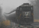
The Siskiyou Line

Post your FREEWARE 'Works in Progress' here!

Re: The Siskiyou Line

Unread postby BoostedFridge » Wed Apr 26, 2017 3:48 am

Thank you all for the kind words!

minerman146 wrote:Boosted,
What your doing just with the ground textures is very impressive. Variety, placement and care is what I see. Your tilting the grass assets to get them to conform to the slope as well. Such good stuff here to see. I saw this post this morning and I immediately, spruced up a "bare" area of my own in your honor. What your doing is not super detail it ...it is super "nature", such smooth transitions between textures, I can tell your painting on the ground.
Love it!
MM


Thank you Miner! You are too kind. I sometimes get carried away trying to get each asset on just the 'right' angle, offset, or scale, when most would never spot if a corner of grass or bush was 'floating'. When it comes time for the beta release I just hope that it all passes the 'eye test'!


Ericmopar wrote:I know from experience, that what Boosted is doing, takes a lot more hours, but in the end it's worth it.


You're absolutely right Eric. When I started on the scenery I used to 'rush' areas just trying to get more miles complete, only to revisit them later to get them up to the standard of the rest of the route. Its slow and steady for me now. Your Donner Redux was a great source of inspiration, and techniques for me!


Progress in the Sacramento River canyon has reached the area near the former siding site of Small. Below is the 'before' picture of what will be the SP's 16th crossing of the Sacramento River. I hope to have this area complete by the weekend.

Bridge at MP324.99.jpg
You do not have the required permissions to view the files attached to this post.
User avatar
BoostedFridge
 
Posts: 2277
Joined: Sat Aug 24, 2013 6:39 am
Location: Vancouver, BC

Re: The Siskiyou Line

Unread postby BoostedFridge » Sun Apr 30, 2017 8:28 pm

Another half mile of scenery completed in the canyon so far today. I took the opportunity to take a break, and do a little photo run up from Dunsmuir.

Today's consist is the hot eastbound 'OABRT' TOFC train, powered by a trio of Ian's GP60 repainted by GenericZack. Many of the trailers are riding on Thebigroyboyski's excellent TTX Frontrunner model.

20170430174130_1.jpg


20170430174232_1.jpg


20170430174346_1.jpg
You do not have the required permissions to view the files attached to this post.
User avatar
BoostedFridge
 
Posts: 2277
Joined: Sat Aug 24, 2013 6:39 am
Location: Vancouver, BC

Re: The Siskiyou Line

Unread postby VITORMARQUES » Mon May 01, 2017 6:22 am

Wow, better and better...
VITORMARQUES
 
Posts: 75
Joined: Sun Jun 20, 2010 7:41 pm

Re: The Siskiyou Line

Unread postby BoostedFridge » Mon Jul 10, 2017 3:27 am

Update time!

Its been a while since my last update. My other hobby (drag racing) has been eating up most of my spare time for the past two months, so time spent on TS and the Siskiyou have been scarce. I have several weeks before the next race, so I intend to get as much done on the route as I can in this time.

On the southern end of the route I have completed scenery up to the siding at Small, in the Sacramento river canyon. Between Small, and the next siding at Mott, I have many hours of terrain smoothing to profile the slopes of the canyon to contour smoothly to the river, and three levels of roadbed snaking uphill. After that process I can place trackside scenery. The plus side to this, is the next 2 miles of scenery will cover almost 7 miles of track due to the double horseshoe curves.


At the north end, on the Siskiyou Line proper, I have completed scenery up the 'west' slope of Snowden Hill. I also began signalling the line with Rick Grout's wonderful semaphores. This process revealed some flaws in how I had originally laid the track, which has led me to redo a large section between Snowden and Hornbrook. I'm still not completely satisfied with my terrain textures for arid hills in this area, and may have to make some more textures to properly represent the area.

Rest assured, this route is being worked on, and will be completed. It will just take however long it takes to complete the task properly. In the meantime, I hope you enjoy the screenshots.


The bridge across the Sacramento River at MP324.99. Compare with my previous post.
20170710002906_1.jpg


A photo by Robert Morris of a train crossing the bridge, followed by my attempt to recreate the scene in TS.
Mossbrae IRL.jpg


Mossbrae TS.jpg


The site of the former station and spur at Shasta Springs.
Shasta Springs.jpg


The 'west' switch at Small siding, looking south.
West Switch Small.jpg
You do not have the required permissions to view the files attached to this post.
User avatar
BoostedFridge
 
Posts: 2277
Joined: Sat Aug 24, 2013 6:39 am
Location: Vancouver, BC

Re: The Siskiyou Line

Unread postby Tomcat » Mon Jul 10, 2017 6:35 am

Looking good! I like that last shot quite a bit.
Download the PRB from page 51 of the Powder River Basin thread.
User avatar
Tomcat
 
Posts: 709
Joined: Wed Mar 23, 2016 9:23 am

Re: The Siskiyou Line

Unread postby ET44C4 » Mon Jul 10, 2017 7:23 am

The way the scenery blends in with the ground textures make this route one of the best I have ever seen. Amazing job !!*ok*!!
**Not taking any requests**

Santa Fe All The Way
Nothing Runs Like a Deere
No Farms No Food
Ford Powerstroke

My 87 Ford: https://www.youtube.com/channel/UCvNRba ... _tNs53k42w
User avatar
ET44C4
 
Posts: 3187
Joined: Mon Aug 22, 2016 12:01 pm
Location: Clover, South Carolina

Re: The Siskiyou Line

Unread postby LandN » Mon Jul 10, 2017 8:03 am

Looking forward to D/Ling it.
LandN
 
Posts: 375
Joined: Sun Feb 15, 2009 11:24 am

Re: The Siskiyou Line

Unread postby buzz456 » Mon Jul 10, 2017 8:30 am

Interesting about your technique on the route. I do a kind of rough run through on a stretch then go back and fill in the blanks go do something else and then come back and fill in some more detail. I like driving a train up and down the route and stopping every now and then and adding stuff until I'm pretty happy with the results so a particular stretch is a wip for quite a while.
Buzz
39 and holding.
"Some people find fault like there's a reward for it."- Zig Ziglar
"If you can dream it you can do it."- Walt Disney
Image
User avatar
buzz456
Site Admin
 
Posts: 20939
Joined: Sun Mar 21, 2010 8:30 am
Location: SW Florida

Re: The Siskiyou Line

Unread postby ErikGorbiHamilton » Mon Jul 10, 2017 1:31 pm

Looking Good Boosted!
User avatar
ErikGorbiHamilton
 
Posts: 1580
Joined: Fri Aug 23, 2013 2:41 pm

Re: The Siskiyou Line

Unread postby BoostedFridge » Tue Jul 11, 2017 4:00 am

buzz456 wrote:Interesting about your technique on the route. I do a kind of rough run through on a stretch then go back and fill in the blanks go do something else and then come back and fill in some more detail. I like driving a train up and down the route and stopping every now and then and adding stuff until I'm pretty happy with the results so a particular stretch is a wip for quite a while.


I find that compartmentalizing my tasks helps me get the scenery down most efficiently. Whenever I take a break for a 'photo run' , I end up driving the train for a few hours!


I start by 'smoothing' the terrain. Depending on how good the DEM resolution is, and how close the roadbed is to embankments and cliffs, will determine how much work this is. This canyon has been a real pain, and I end up having to adjust all the tile vertices one at a time. Tonight it took me about 90 minutes to smooth out 3/4 mile of terrain along the tracks.
20170710202547_1.jpg


Once the terrain is neatly in place along the tracks, and the embankments are fairly uniform, I do a 'rough' terrain paint on the area. If I have already figured out the textures that suit an area the best, then this is pretty quick.
20170710222031_1.jpg


Then its time to add the trackside scenery assets. I use an LOD of 10 for the assets immediately beside the track, and an LOD of 6 or 7 for assets further away. This can be a slow process in areas like this where the terrain is uneven, and there are multiple embankment angles by the roadbed. The constant curves of the track don't help either. These variables made me use fairly small scenery assets here, and the smaller the asset, the more of them I have to place and position. The time spent smoothing the terrain makes this much easier then it could be otherwise though.
20170711002431_1.jpg


After the ground assets are down, I add 'accent' terrain textures to help blend the scenery assets in, and bring out the 'feel' of an area.
Next I'll add more distant scenery, 2d trees in this case. Asset blocks are very useful for this. Once they are in place, I again paint around the trees, and add more textures to help blend them in.
20170711010056_1.jpg


This is what I call about 80% done. I still need to add 3d trees along the tracks, other detail assets like rocks in the river, and trackside debris.
20170711010707_1.jpg


Its a slow process, but I hope you agree that its worth it for the finished result!
You do not have the required permissions to view the files attached to this post.
User avatar
BoostedFridge
 
Posts: 2277
Joined: Sat Aug 24, 2013 6:39 am
Location: Vancouver, BC

Re: The Siskiyou Line

Unread postby JohnS » Tue Jul 11, 2017 6:47 am

Wow! There's a small 4.5 mile route that I want to build but I've tried to start several times but I don't know what I'm doing. You're doing great work. So much talent on this forum. **!!bow!!**
User avatar
JohnS
 
Posts: 1116
Joined: Sun Dec 29, 2013 6:48 am
Location: Portage IN

Re: The Siskiyou Line

Unread postby Tomcat » Tue Jul 11, 2017 6:54 am

It is definitely worth it!

Seems like we all work in a similar fashion. While I rough out an area I may wind up driving it 4 or 5 times just looking for anything that doesn't seem right or seems a bit bare, and quite often I wind up 20 miles away going into the editor every mile or so to place an asset or 10. And much like Buzz, any particular section is a WIP for quite some time... some sections have been a WIP since day one. In any case, keep up the great work, go slow and most importantly have fun!
Download the PRB from page 51 of the Powder River Basin thread.
User avatar
Tomcat
 
Posts: 709
Joined: Wed Mar 23, 2016 9:23 am

Re: The Siskiyou Line

Unread postby Ericmopar » Tue Jul 11, 2017 2:28 pm

Looks great, you're doing a fantastic job Boosted.
New build. i7-7700k, MSI Z270 Gaming M5 Mobo, Hyper 212 Evo, Corsair DDR4 3200 Mhz RAM, Klipsch Pro Mediea 2.1 Speakers, Samsung 850 Evo SSD, HAF XM Case, Asus Strix GTX 1070 and Cooler Master Storm XT Keyboard.
Slick with Pretty Rainbow Colors.
User avatar
Ericmopar
 
Posts: 2814
Joined: Mon May 13, 2013 12:35 am
Location: Henderson NV.

Re: The Siskiyou Line

Unread postby _o_OOOO_oo-Kanawha » Wed Jul 12, 2017 6:10 am

Looking great indeed!

I can imagine your pain and despair trying to smooth out all those DEM scan lines. Is mountainous area with narrow valleys more affected by them?
Edwin "Kanawha"
Image
The Chessie, the train that never was ... (6000 hp Baldwin-Westinghouse steam turbine electric)
User avatar
_o_OOOO_oo-Kanawha
 
Posts: 3231
Joined: Mon Nov 14, 2011 2:12 pm

Re: The Siskiyou Line

Unread postby BoostedFridge » Wed Jul 12, 2017 11:24 am

Thanks all!

_o_OOOO_oo-Kanawha wrote:I can imagine your pain and despair trying to smooth out all those DEM scan lines. Is mountainous area with narrow valleys more affected by them?


Depending on the 'resolution' of the SRTM data, yes.

1 arc second loses detail on elevation changes closer than 30 yards/meters, and consequently the DEM is 'averaged' out and not good for canyon floors, Or rail grades carved into canyon walls. 1/3 Arc second (which I am using) is accurate to within 10 meters/yards. Where it falls short is when you have the canyon walls covered in trees right to the river at the bottom. The satellite radar shows the forest canopy as the ground level and then 'loses' a narrow river. 1/9 is available for many waterways in the USA, but in this instance, when I merged the two DEM types together, there was so much of a 'jump' in elevation where they joined, that I decided to just manually smooth and contour the river bottom. Much of the fine adjustment that I am doing now is the result of me being heavy handed with the 'lower' tool during the track laying process here *!embar*!
User avatar
BoostedFridge
 
Posts: 2277
Joined: Sat Aug 24, 2013 6:39 am
Location: Vancouver, BC

PreviousNext

Return to Freeware WIP

Who is online

Users browsing this forum: No registered users and 1 guest