A bit delayed is this weeks route update. For this week, it is the report only as we did not fill in enough scenery around the Woodbury Trestle to justify a release. ( NSTrains - your QD request was fulfilled, but I haven't released yet. Do look for an update this coming Friday.) The big change to the route is a huge one. We are finally able to import STRM into the route. Since the last update, I have used DEM to fill in the scenery along the entirety of the Schunemunk Ridge. This runs from Monroe, NY, which is just West of Harriman Station to the Moodna Viaduct. DEM IS AMAZING! All the little hills, I simply could not get in with the limitations of the terrain tool, are now there. There are some stunning stream cuts and ridges that you will be able to see. For those of you not familiar with the "Southern Tier" of New York - you can see why it would have been very unlikely that this route ever would have been built commercially. Its nothing but hills in Orange County, NY. With these additional contours, I believe that the additional terrain has an fps cost, because of rendering all the slopes. I estimate a 20% drop in FPS because of the terrain. You will find out next week. I also expended about 6 hours this weekend loading DEM terrain around the edges of the existing route, so expect to see many more mountains in the distance than ever before. You may be curious, as I was, about how close my hand made terrain came to DEM. Well, of course it was off, but not so much so that I was alarmed. But, I absolutely CANNOT import new terrain over my existing work. I did a test on laying DEM over existing areas. I give it a grade of "not too shabby". For some odd reason I'm looking at a 18 foot terrain height difference from Mahwah to Ridgewood. My track and terrain is too low. I will add this, it is VERY clear from a topo standpoint that, as we know, Erie Railroad engineers followed valleys whenever and wherever they could.
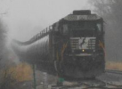
I have not posted animage in a while - and that is because I don't have much new and finished terrain to show you. But here is todays shot: The is a South facing shot - still in the Town of Woodbury of the Woodbury Trestle:
24010_screenshots_20170305133049_1.jpg
Regarding route progress.
One of my favorite subscribers, well there are many. But, the one I want to recognize one in particular, is ex-railwayman. What makes ex-railwayman stand out is that he reads. As you know, I heavily post here on RWA, but also I post every day on my route Work-In Progress "WIP" page. There I have posted over 925 times since the route was first released to record my work time and what I am working on. Its my journal of the route. Mr. ex-railway man pointed out to another user to read my WIP page that reading would have answered the question of "are you going to Cornwall-Salisbury Mills?" So, do keep reading. I post either at the end of a work period or within 24 hours. Sometimes I go into detail, but over all its shows my work flow, which may be interesting. Reviewing the WIP page shows the ungodly hours put in to the route, not just over all time but what hours I work and when. I suspect at ex-railwayman has figured that out. And I appreciate it.
And finally - I am happy to note, that, from here on in, every mile gets closer to the inevitable end of construction. The journey has been all the fun and it will be bittersweet, when, at long last, I can push the "finalize" button and become a part of Railworks history.
MM
You do not have the required permissions to view the files attached to this post.


