ReDem terrain tile boundary?

Discussion about RailWorks route design.

ReDem terrain tile boundary?

Unread postby BoostedFridge » Tue Jul 08, 2014 8:09 pm

Hi guys,

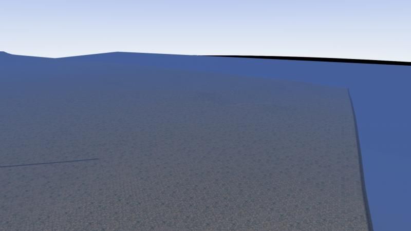
I've been laying track on my route for a few days now, quite happy with my DEM terrain imported via ReDem. Today I laid track out of a valley, over a crest, and realize that there is nothing on the horizon, and that I've hit the proverbial 'edge of the world'. (See below)
Image

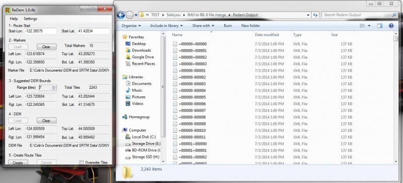
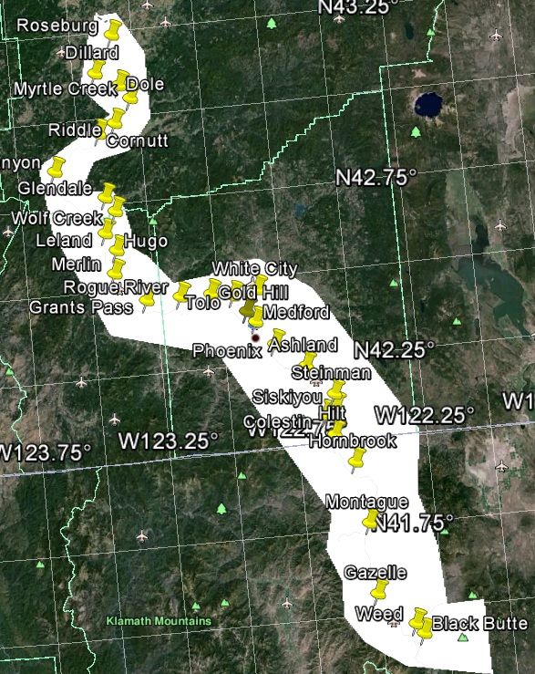
I'm only about 8 miles from my route starting point, and it appears that I'm out of terrain. I searched on this, and I see some people get 'gaps' between tiles, but this appears to be something much worse. I double checked to make sure that I'm within the 'polygon' that I exported from Google earth to the USGS site for the BIL files. Also, I'm well within the Latitude and Logitude range shown in ReDem when it generated my tiles. (see below)
Image

Does anyone have any idea why the rest of the terrain isn't loading? Do I have to do something manually to get new tiles to load?

Any help would be appreciated.
Image
User avatar
BoostedFridge
 
Posts: 2277
Joined: Sat Aug 24, 2013 6:39 am
Location: Vancouver, BC

Re: ReDem terrain tile boundary?

Unread postby Bananarama » Tue Jul 08, 2014 9:25 pm

Was your DEM data 1/3 or 1/9 arc second? If the latter, youll find it's fairly spotty in the Siskiyous, and almost non existant south of Dunsmuir. For those areas you'll need to use 1/3 or SRTM DEM to fill the voids.
Cheers!
Marc - 3DTrains

Image
User avatar
Bananarama
 
Posts: 2749
Joined: Sat Feb 14, 2009 1:17 am
Location: Another Planet

Re: ReDem terrain tile boundary?

Unread postby BoostedFridge » Wed Jul 09, 2014 12:58 am

Its all 1/3 arc second data from the USGS site, downloaded in IMG format. I saw that the 1/9 stuff was limited to the more populated areas, so I went 1/3 to keep the DEM consistent. If I was to 'fill' in any blank areas with SRTM, it would have to be in 1 arc second for railworks to handle it right? How do you select where the SRTM would start, and the higher quality DEM ends?
User avatar
BoostedFridge
 
Posts: 2277
Joined: Sat Aug 24, 2013 6:39 am
Location: Vancouver, BC

Re: ReDem terrain tile boundary?

Unread postby Bananarama » Wed Jul 09, 2014 10:30 am

The SRTM can be imported using the built-in RW tools. Control of how many tiles out is contained in the menu when you select the import icon. Navigate directly over the first void in the DEM and select import. When the menu appears, select 1 x 1 and only the tile you're over will come in. You can also adjust your position to an extra tile out, and choose 3 x 3.

What I did to create series markers defining the outer most boundary of where my tiles needed to be. I then used ReDem to create my initial tile set, and then while in the RW editor, navigated to the boundary markers and worked my way inward to the "good" DEM using a 9x9 import routine in RW. When I got close to the good stuff, I began reducing my import tile sizes to ensure none of the ReDem terrain was overwritten. Most of the Dem came in OK using ReDem, but much of the area around My Shasta and the McCloud RR was full of holes that needed to be filled in (there's also several large swaths missing between Grass Lake and Kegg, but this is along the Cascade line).

The biggest problem is that there's no undo feature. If you make a mistake, you'll need to exit and restart the process. Each time you get a good import, save before continuing on.

The whole process is an easy one, albeit extremely tedious. Took me two or three days to get everything in place. !**duh*!!
Cheers!
Marc - 3DTrains

Image
User avatar
Bananarama
 
Posts: 2749
Joined: Sat Feb 14, 2009 1:17 am
Location: Another Planet

Re: ReDem terrain tile boundary?

Unread postby BoostedFridge » Wed Jul 09, 2014 2:53 pm

Thanks Marc! I really appreciate the help. Are the voids in DEM always exactly one tile? ie: if there is any DEM issue within a tile, Redem or Railworks will make the whole tile blank? Also, how big is a tile in RW anyways?
User avatar
BoostedFridge
 
Posts: 2277
Joined: Sat Aug 24, 2013 6:39 am
Location: Vancouver, BC

Re: ReDem terrain tile boundary?

Unread postby BoostedFridge » Wed Jul 09, 2014 8:30 pm

Okay, so I figured my problem out.

I noticed that in the areas that my DEM did load, that it was always in a 16 tile x 16 tile square, with the railroad almost always near the center. Then I would get a huge gap before the next chunk of DEM, again in 16x16. I clued in that the DEM was centered around the markers that I had used in my marker file for ReDem. I had misunderstood how Redem calculates the areas where to generate the terrain. I assumed that Redem would 'fill in the blanks' between markers, whereas it really just makes a radius of terrain around each marker. I went back and added a bunch more markers, processed the whole works through ReDem again, and voila; 100 miles of uninterrupted 1/3 DEM terrain. Back to track laying I go...
User avatar
BoostedFridge
 
Posts: 2277
Joined: Sat Aug 24, 2013 6:39 am
Location: Vancouver, BC


Return to Route Design

Who is online

Users browsing this forum: No registered users and 3 guests

cron